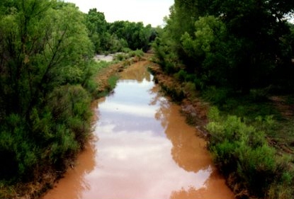
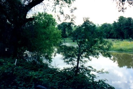
A view of the San Pedro River, looking south from the foot bridge near present day Charleston Road, which is also south of the historic Charleston Bridge, now lost to history.
Given that this amount of water is rare in the San Pedro River, locals often travel there to take such photos as its unusual to see the river with water in it. Arizona is unique in this regard. Many waterways noted on Arizona maps are largely dry year around, and only appear like this after intermittent rainfall. But creeks sometimes do have more consistent water flow than even rivers.
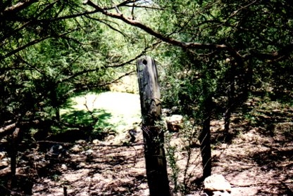
McGrew Spring, in the Whetstone Mountains, near the present day Arizona State Park of Kartchner Caverns.

The above two photos are of McGrew Spring, in the Whetstone Mountains, near the present day Arizona State Park of Kartchner Caverns.
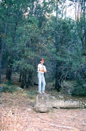
John Rose at Mescal Spring, in the Whetstone Mountains. Mescal Spring is near Iron Spring, where Wyatt Earp gunned down Curly Bill Brocius, but not the same location.
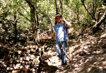
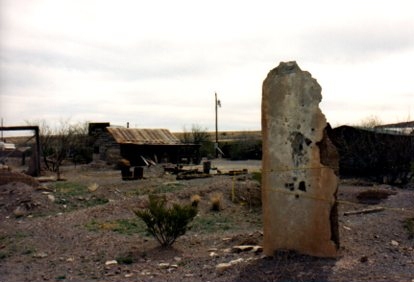
John Rose stands on one of the last remaining remnants of the Morse sawmill. The site is littered with trash some of which dating to teh 1880's, some later. It may have remained in use after Morse had moved on.There is a primitive spring box at this location which still has water in when this photo was taken, giving yet one more reason for Morse to have chosen this site in the first place.
The Morse sawmill was a key location in the Chiricahua Mountains, supplying lumber to a booming Tombstone, and would also briefly surface in the coroner's report regarding the death of John Ringo. "...There was found by the undersigned John Yoast the body of a man in a clump of Oak trees about 20 yards north from the road leading to Morse's mill and about a quarter of a mile west of the house of B.F. Smith."
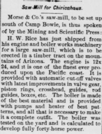
On June 6, 1879, the Arizona Citizen notes that the Morse saw-mill will soon be in operation in the Chiricahuas, which offered rich timber for production. The Morse mill was well located for supplying the needs of nearby military sites such as Rucker and also Bowie. Tombstone's rapid rise occasioned a great need for additional lumber, consuming shipments as fast as they could arrive when the camp was in full stride of its early boom.
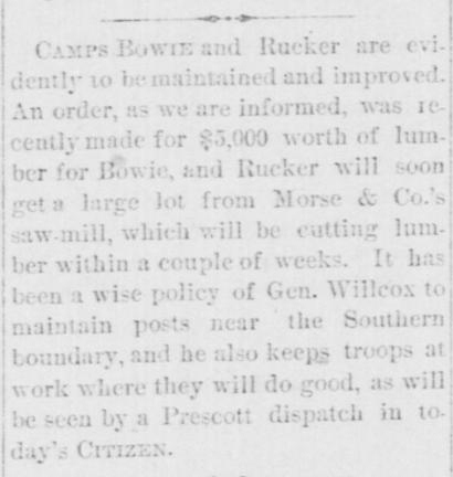
The Morse mill soon received an early, substantial government lumber contract for Fort Bowie and Rucker. Arizona Citizen July 5th, 1879.
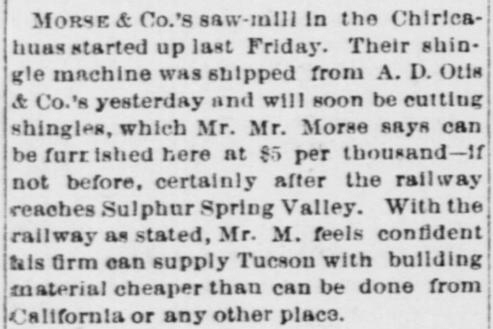
Morse would soon acquire a shingle machine, allowing him to further penetrate the home building boom at Tombstone providing roofing materials, as well as other boom-towns in the area. Arizona Citizen, July 25, 1879.
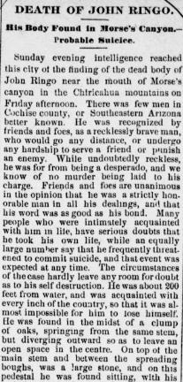
July 22nd, 1882 brought news to the readers of the Tombstone Weekly Epitaph that John Ringo had been found dead in the Chiricahuas. This is a portion of that article.
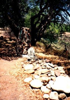
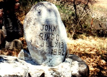
The above two photos are of Ringo's grave.
This is the view of Turkey Creek from Ringo's grave. Taken in the summer time after a substantial rain, it shows the very aesthetic nature of the place. But it also shows the danger to the grave site. If the cutting of Turkey Creek continues, it is possible that one day Ringo's grave may be lost due to the widening of the Creek.
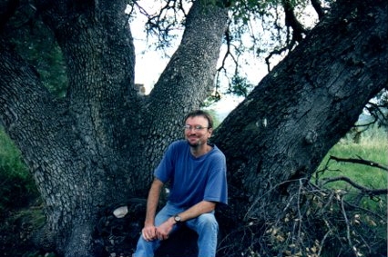
John Rose seated at whats commonly referred to as "The Ringo Tree," where Ringo was found dead. As it was explained to me by the owner, what is known as the "Ringo Tree" is actually a combination of two trees growing together, the portion on the right being a different tree than the one on the left. This differs with the description of this location as offered by Jack Burrows, author of the important book "John Ringo The Gunfighter Who Never Was."
In more recent years the tree that veers to the right was damaged by a storm, but the portion on the left remained undamaged and healthy, at the time of my last visit to the site, offering anecdotal evidence to argue in favor of the owners understanding of the tree[s]. I once visited this site with a tree expert who further verified this understanding. I would like to thank the owner of this site, Jerry Sanders, for his many years of hospitality that he has afforded me, and mourn with him the loss of his mother who was always very kind to me, and lived to be 96 years old.
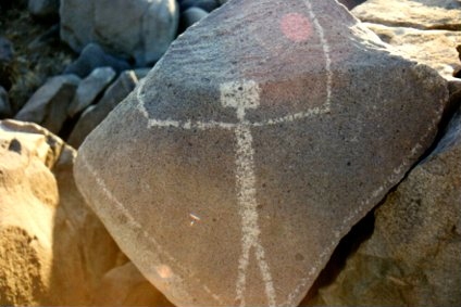
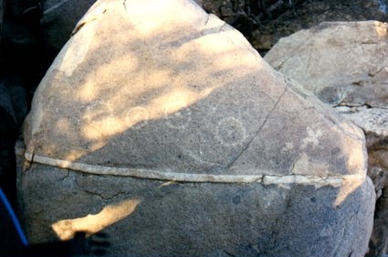
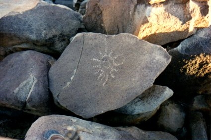
Indian rock art near the San Pedro River, south of Charleston. Due to the sensitivity of these sites, and the danger of thieves attempting to remove and steal such treasures, I will under no circumstances make known these all important locations.-John Rose
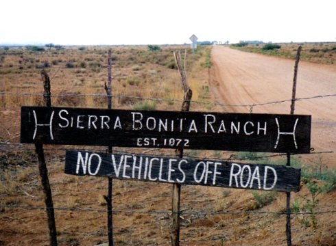
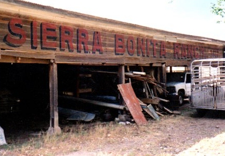
Colonel Hooker's memorable ranch near Wilcox Arizona, the Sierra Bonita. This ranch showed up briefly during the Earp Vendetta as the Earp posse and Behan's posse both visited this area.
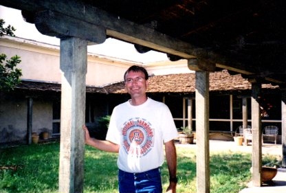
John Rose in the courtyard of the Sierra Bonita Ranch, one of the great ranches of the Arizona Territory.
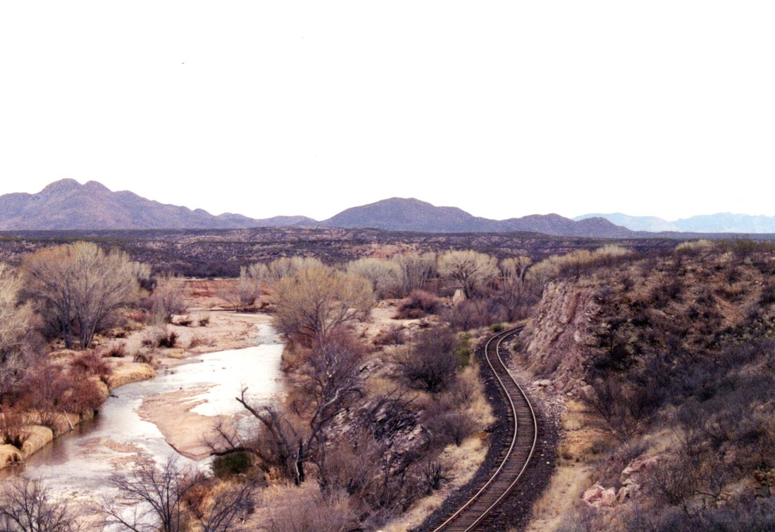
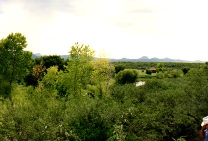
Landscape as seen from the San Pedro and Southwestern Railroad.
Facing toward the Millville area, the light that day was ideal for a photo. The semi-fours visible that installed by the railroad are now gone.
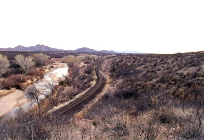
Above and below, a view of the San Pedro River with the railroad bed still intact, years before its removal.
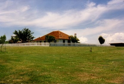
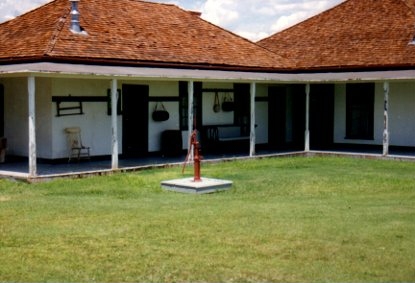
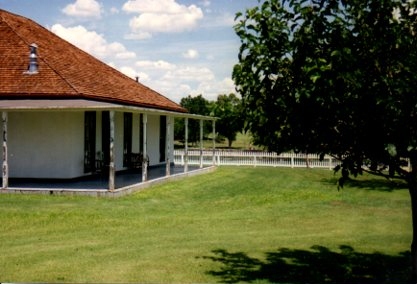
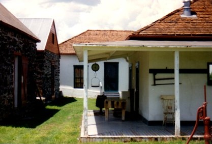
John Slaughter's Ranch, outside of present day Douglas Arizona.
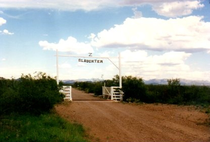
The gate as you enter the Slaughter Ranch.
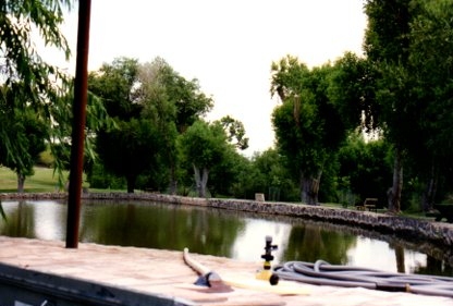
A water tank at Slaughter's Ranch.
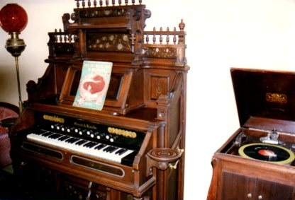
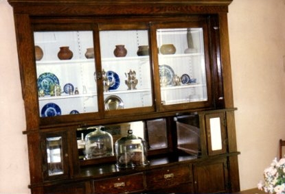
This cabinet isn't leaning to the left as this photo appears to show, I had the camera angle wrong!
Slaughter picked an area with great advantages for any settler, especially a rancher. His site contains fresh spring water and a commanding view into Mexico.
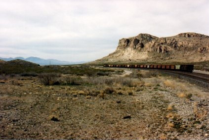
Steins pass is an historic area that figures prominently into the history of two states, New Mexico and Arizona. This long view of the area shows railroad cars in the distance-the railroad once gave life to the railroad town of Steins.
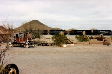
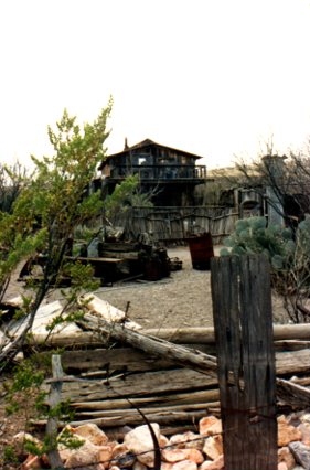
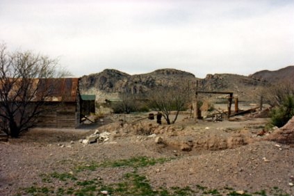
This photo above and the three photos below are of the Steins ghost town, just across the line from Arizona inside the state of New Mexico. I was shocked to learn of the murder of the owner of Stein's, and understand that visiting the site may be more complicated than it once was from articles on the net. With this in mind, I'd like to share with my worldwide readership photos I took of the site in the 1990's, and offer my deepest condolensces to the family affected by this tragedy. -John Rose
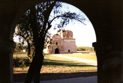
Tumacacori Park, near Nogales Arizona, a terrific step into the past, and the history of the area.
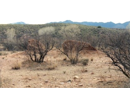
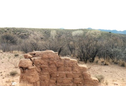
Old Camp Wallen, near the Babocomari River. When Samuel Marmaduke Whitside was ordered to select a location for a new U.S. Army Fort to be constructed in the southeastern corner of the Arizona Territory, he first visited this site at the suggestion of legendary scout Merejildo Grivalva. An outbreak of mosquitoes gave Whitside pause to rethink this location, and he traveled further south into the Huachuca Mountains, founding the location still in use today known as Fort Huachuca.
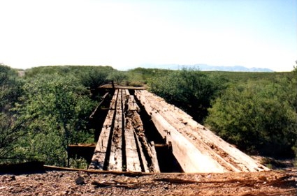
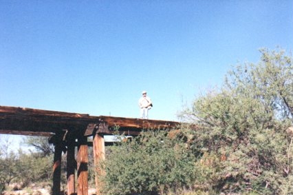
John Rose stands on one of the remaining bridges on the El Paso and Southwestern railroad, that arrived in Tombstone in 1903.
Copyright John D. Rose, 2014-2018. All rights reserved.